(9 Oct 2024)
RESTRICTION SUMMARY: PART MUST CREDIT NASA
NASA – MUST CREDIT NASA
ARCHIVE: Space – 08 October 2024
++MUTE FROM SOURCE++
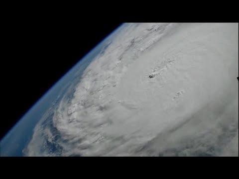
1. Various of Hurricane Milton from the International Space Station
ASSOCIATED PRESS
Washington D.C. – 9 October 2024
2. SOUNDBITE (English) Seth Borenstein, The Associated Press:
“Hurricane Milton isn’t just a life-threatening monster for Florida. It’s an unusual, but not unheard of, freak of nature storm. Why? Mostly because of its strength and its track, and a good part of that can be credited or blamed on the extremely warm water of the Gulf of Mexico.”
ASSOCIATED PRESS
ARCHIVE: Progreso, Mexico – 8 October 2024
3. Various of palm trees blowing around in heavy winds
4. Wide of waves
5. Wide of a broken dock
ASSOCIATED PRESS
Washington D.C. – 9 October 2024
6. SOUNDBITE (English) Seth Borenstein, The Associated Press:
“It was born in the Bay of Campeche in far southwestern Gulf of Mexico. Most Gulf of Mexico storms go north or they’re coming in from the east, just below Florida, and they sort of go north and west. Milton is going northeast, which is unusual, but it’s not unheard of. Other storms have done this in the past. But it is an unusual path.”
ASSOCIATED PRESS
ARCHIVE: Clearwater Beach, Florida — 8 October 2024
7. Wide of people boarding up windows
8. Various of people preparing sandbags
ASSOCIATED PRESS
Washington D.C. – 9 October 2024
9. SOUNDBITE (English) Seth Borenstein, The Associated Press:
“But what about the strength? That’s what’s really strange here, because Hurricane Milton hit the top of the scale for hurricanes category five, not once, but twice. It even hit 180mph once. Why? It’s fueled by this extreme warm water in the Gulf of Mexico.”
NASA – MUST CREDIT
ARCHIVE: Space – 9 October 2024
++MUTE FROM SOURCE++
10. Various shots of Hurricane Milton and cloud cover in Gulf of Mexico
ASSOCIATED PRESS
Washington D.C. – 9 October 2024
11. SOUNDBITE (English) Seth Borenstein, The Associated Press:
“So why is the water so warm? One of the main reasons here is climate change. Human caused climate change has warmed up the waters everywhere. But the waters of the Gulf, the Caribbean and the Atlantic have been at near-record levels for a year and a half.”
ASSOCIATED PRESS
ARCHIVE: Venice, Florida – 8 October 2024
12. Close of a sandbag station sign
13. Various of people filling up sandbags
NASA – MUST CREDIT
ARCHIVE: Space – 9 October 2024
++MUTE FROM SOURCE++
14. Various shots of Hurricane Milton and cloud cover in Gulf of Mexico
ASSOCIATED PRESS
Washington D.C. – 9 October 2024
15. SOUNDBITE (English) Seth Borenstein, The Associated Press:
“Milton is dangerous for another reason because of where it’s going and where might go. It’s going to hit somewhere in the Gulf Coast of Florida, somewhere from around Tampa south. If it hits Tampa Bay, that’s sometimes one of the worst-case scenarios the scientists have worried about. That’s because Tampa Bay has not had a major hurricane directly hitting it in more than 100 years.”
ASSOCIATED PRESS
ARCHIVE: Tampa, Florida – 9 October 2024
16. Various of a riverwalk in Tampa ahead of Hurricane Milton landfall
STORYLINE:
With its mighty strength and its dangerous path, Hurricane Milton powered into a very rare threat flirting with experts’ worst fears.
At its most fierce, Milton almost maxed out its potential intensity given the weather factors surrounding it.
That’s more than triple the average annual rate of such monster landfalls in the U.S. since 1950, according to a data analysis by The Associated Press.
Find out more about AP Archive: http://www.aparchive.com/HowWeWork
Twitter: https://twitter.com/AP_Archive
Facebook: https://www.facebook.com/APArchives
Instagram: https://www.instagram.com/APNews/
You can license this story through AP Archive: http://www.aparchive.com/metadata/youtube/f5cfcaab683242d0bdd13a6a0d4951c6
Author: AP Archive
Go to Source
News post in October 15, 2024, 12:05 am.
Visit Our Sponsor’s:
News Post In – News


